
Okay, so last time I talked about moving more to a model where I focused more on accuracy with neighbor connections vs. worrying so much about which exact in-city tile a particular road or intersection was on.
So I moved a bit south from Madeira, into Madisonville. I already had the neighbor connections for Kenwood and Whetsel Roads, but I spent a bit of time going around to each border, plotting via Google Maps the tiles that some of the major roads come into Madisonville.
As I’ve defined Madisonville, it goes from 39.148 to 39.167 North Latitude, and from 84.408 to 84.385 West Longitude. So a little something like this.
Here was where I ended up
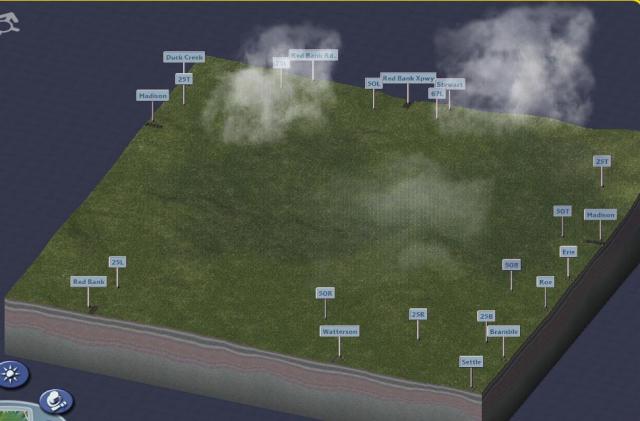
What do you think?
Next step will be to put in the basic roads and intersections

I take it since you’ve haven’t posted on your blog since December you’ve quit working on this? I live in Fairfield and I’m interested in seeing the ending results.
Yeah – it was too hard to reconcile the directions of the city with the fact that you can only make roads in SimCity in straight lines. It got me too frustrated that I couldn’t make it “exact”
You can have Dobdriver from the SC4 Devotion website make the map for you. He seems to do a pretty good job.
As for NAM, I know what you mean. Though I consider it the best thing to happen to Simcity4, it is very incomplete. There are many basic things that still need to be created for a complete road network.