Okay so the next morning after thinking about things, I realized that NAM (Network Addon Mod) and RHW (Real Highway Mod) are NOT the same thing. The RHW is a subset of NAM, and when I uninstalled my previous version of NAM, that had removed the RHW mod, and when I had installed version 29 of the NAM, I had not re-installed the RHW.
I posted about that over at SC4Devotion (which is a fairly active SC4 modding community) and the helpful poster had come to the same conclusion. When I was able to get back into the game after re-installing RHW, that did indeed fix the problem. So…. yay!
I also looked at the TULeP (Turning Lane Extension Project) project, which changes the behavior of the default road and avenues to add turning lanes and such. So after looking at some of the details, it looked like the best way to lay out Kenwood Road would be to make it an avenue, and add the TULeP pieces to put in the right turn lanes.
Then I ran into my first problem. Hamilton County is not straight. Here’s a quote from the Madeira Historical Society
“When the early surveyors mapped most of Hamilton County, including Madeira, they laid their section lines on magnetic north rather than true north. So Miami Road is about three degrees west of true north. By the time they got a few counties north of here, they were using true north. So we’re cocked a bit to the east.”
Curse you John Cleves Symmes!!!! So all my roads are crooked. So for instance Kenwood Road, which is a major North-South road (and I believe an original section line from the above quote) comes into “Madeira” at 93 pixels from the left. But by the time it gets to its intersection with I-71, it’s at 88 pixels from the left. And at Euclid it’s 86, Dawson 83 and Shawnee Run it’s 80 from the left. So every 8 or 9 pixels we go down it needs to go over 1 pixel to the west.
I briefly toyed around with somehow shifting the whole region over 3 degrees, but a) I don’t think that would work and b) I’m sure there are some roads that are laid out on true N-S or E-W lines, so if I shifted 3 degrees it would just mess up THOSE roads.
There is no current way (as far as I know) to make roads in SC4 at that slight of an angle. I know I can make 45 degree angles, and I think there are mods that will make 30 degree or maybe even 22.5 degree roads, but nothing at the 3-5 degrees that I need.
So I’m reduced to just making jogs every 8 or 9 pixels, which looks kind of crappy. I’m still noodling with that trying to figure out the best way to do that.
But rather than just bash my head on that, I moved on to something else. I started making the TULeP layouts for the Kenwood / Euclid intersection. In browsing the available TULePs, I came across a post from one of the main TULeP developers that had this image.

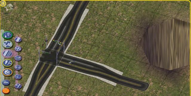
Exactly what I need for westbound Euclid! Alas, after trying to figure out how to place that in-game, I realized that it was only an “in-development” screenshot and as part of the “advanced” TULePs, not available yet. Boo :-(. So I skipped that one, and moved on to the Shawnee Run intersection. After awhile, I had it looking pretty good

Note too the giant crater that somehow I created while messing around. Not sure why that happened but hopefully it won’t be too difficult to fix. Overall, I was pretty pleased with how it turned out.
